
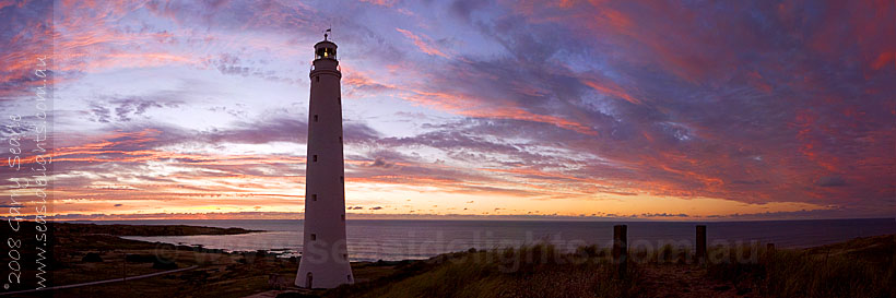
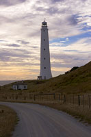
Cape Wickham
|
 Cape Wickham and Cape Otway on Victoria's South Coast, formed the "eye of the needle", leading sailors into the narrow Bass Strait.
After thousands of miles of sea since leaving the Cape of Good Hope in South Africa, navigators had to find their way into a strait less than
90 kilometres wide. The shores of King Island hold the remains of many ships which didn't make it.
Cape Wickham and Cape Otway on Victoria's South Coast, formed the "eye of the needle", leading sailors into the narrow Bass Strait.
After thousands of miles of sea since leaving the Cape of Good Hope in South Africa, navigators had to find their way into a strait less than
90 kilometres wide. The shores of King Island hold the remains of many ships which didn't make it.
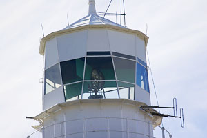
Originally a 1st order fixed apparatus. Brewis recommended that the light be given a distinctive character by inserting an occulting screen, actuated by clockwork mechanism, to be wound every 16 hours. He also recommended that the Signal Station be discontinued. The reason was the reefs that extend for 4 1/2 miles off the Cape Wickham coast, and tides being very treacherous, setting strongly towards the shore. This was a dangerous shoreline and the location for Australia's worst shipwreck. The Cataraqui hit the reefs in 1845 and there were 402 lives lost. 10 years earlier the Neva had also been lost with 225 lives. Brewis wrote that no ship should be encouraged to approach within signalling distance. and in the original report on the lighting of Bass Strait of 1859 it said ..."this light should not be at all considered in a position of a great highway light for the navigation of Bass Strait; and the light at Cape Wickham can only be regarded as a beacon warning navigators of danger, rather than a leading light to a great thoroughfare" The original 1st order lens was removed in 1946 and was installed in Point Quobba, WA. |


|


|